


 Export to Trail Guide
 Create Guidebook
  Download GPX
  Print Friendly Map
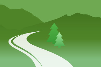
The Napa River Trail parallels its namesake river through the City of Napa from Kennedy Park to just south of Trancas Crossing Park. It is currently open in two disconnected segments.
The southern segment, which follows the east bank of the river from Kennedy Park to just shy of 3rd Street, shares the route with the Vine Trail. Kennedy Park is nestled against the Napa River and has something for the entire family to enjoy. Not only is there a playground for the kids, but numerous outdoor recreational activities including a golf course and picnic tables. It ends near downtown Napa, where you will have access to various shops and restaurants. One unique attraction is the Napa Valley Wine Train. After a day out on the trail, you can treat yourself to some wine and fine dining aboard this railway adventure.
The northern segment follows the river's west bank from Lincoln Avenue to Trancas Street. On one side of the route you will find quiet residential neighborhoods and, on the other side, is the wooded Napa River.
Most visitors arrive to the Napa area via State Highway 29 from the south. Exit Highway 29 on Soscol Avenue and proceed to Streblow Drive to access Kennedy Park at the south end of the trail, where ample parking is available.
Parking is available at the north end of the trail in the Trancas Crossing Park off Trancas Street near Old Soscol Way. The north terminus of the trail is on the southern side of Trancas Street.
Parking between the two ends of the trail is limited.
As a cyclist, my friends and I enjoy the ability to use this trail to make a loop ride. Coming from the north west side of Napa, we ride across town and through Kennedy Park on the Vine Trail. Then, when we loop back, instead of turning onto Vallejo St from Socsol Ave to return across town on the Vine Trail, we continue on Soscol and turn right on Lincoln Ave to get to the Napa River Trail. We take this to Trancas St, then turn right and ride to Silverado Trail (1st left). This takes you up-valley. With a few exceptions, the shoulder is between 10-15 feet wide, making it a safe place to ride 2 abreast. There are cross roads every 4-5 miles to allow crossing to Hwy 29 for the return ride. You can choose the cross road to tailor your route to the length you desire. Hwy 29 also has wide shoulders south of Rutherford. Soon, the Vine Trail will provide a Class 1 route from the north side of Yountville back to Napa.


TrailLink is a free service provided by Rails-to-Trails conservancy
(a non-profit) and we need your support!


